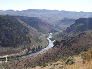
 As the South Fork Boise is currently closed to fishing now is the time to dip into stacks where we can find out a thing or two about the general area where the South Fork flows. This installment is a geology tour. At Idaho State University they have lots of geology information posted on line, including the Guidebook to the Geology of Central and Southern Idaho. In that book is the chapter “Cretaceous and Tertiary Intrusive Rocks of South-Central Idaho,” which includes a tour of the South For Boise River canyon area.
This geology tour begins with the road approaching Anderson Ranch Dam and goes downstream to the Cow Creek bridge where you drive from the South Fork back to Highway 20. Included is a side trip from Cow Creek Bridge to Danskin Bridge.
A couple of notes. The zero point for the tour, shown as 0.0, is the intersection of Sun Valley Road and Main Street in Ketchum. So the tour approaches the South Fork Boise from the east. Secondly, the interval mileage is shown in parentheses. Here goes:
0.0 (0.0) Intersection of Sun Valley Road and Main Street, Ketchum. Leave Ketchum on State High- way 75, heading south toward Hailey and Bellevue.
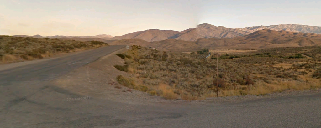
110.0 (110.0) The Danskin Mountains, the low hills visible to the left (south) of House Mountain, expose Idavada Volcanics on top of Cretaceous grano- diorite.
The skyline to the north is the Trinity Mountains, underlain by Eocene granodiorite and pink granite.
113.6 (1.3) Turn right to Anderson Ranch Dam and town of Prairie. Pass through old townsite of Dixie. On the skyline, the flat-topped peak to right is Cretaceous granodiorite. Peaks to north on the skyline are the Trinity Mountains.
115.1 (1.5) Highly sheared aplite and pegmatite to the right.
116.5 (1.4) The mine dump to the west (left) is the King shaft of the Golden King mine. The shaft connects to a tunnel in the bottom of the South Fork Boise River canyon almost 900 feet (270 m) below the road. The mine was developed in the 1930s by the Daly Consolidated Mining Company. Metamorphic rocks are exposed in the shaft. The ridge just southwest of the shaft is capped by quartzite and is part of the House Mountain metamorphic suite. The hill in the foreground, just east of the quartzite-covered hill, is a rhyolite dike of uncertain but possible Eocene age. The low hills between the road and the rhyolite are aplite and pegmatite. Hills to the east of the road are sheared aplite and pegmatite at their base and aplite and pegmatite with metamorphic fragments higher up.
116.9 (0.4) End of pavement. Note canyon-filling basalts (age-equivalent to Snake River Plain basalts) across the gorge. Ridge above is called Granite Ridge for the expected reason.

On the drive to the top of the dam, about halfway down the hill, note massive pegmatites and aplites that make up about 50 percent of the exposures. Most dikes strike east-west and dip north. Gray granodiorite occurs as screens between the dikes. Gray grandiorite occurs as screens between the dikes. There are also good exposures of young basalt dikes and older andesite/dacite dikes in this cut. A basalt dike near here was dated by Armstrong (1975b) at 12.1 +/- 1.2 Ma which he believes is younger than the true age.
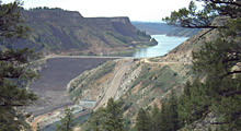
118.6 (1.7) Turn left and drive across Anderson Ranch Dam, on the South Fork Boise River. The Bureau of Reclamation dam was completed in 1950 as part of the Boise Area Irrigation Project. It also generates electricity. Dam is 456 feet (138m) high and 1,350 feet (409m) long.
118.8 (0.2) Turn left and go down the hill.
 119.3 (0.5) A look back toward the spillway reveals aplite and pegmatite dikes cutting biotite granodiorite and all cut by a basalt dike.
121.5 (2.2) Road to the right goes to Reclamation Village, home of the crews who operate the dam. In 1950 1,500 people lives in the area. Population has diminished with automation and remote control.
123.4 (1.9) This is the first outcrop in which we see an appreciable amount of metasedimentary rock of the House Mountain metamorphic suite. Most of the outcrop is Cretaceous granodiorite with aplite and pegmatite, but the small inclusions of metasediments are recognizable.
125.2 (1.8) Increasing amounts of metamorphic rock here below Sproule Flat.
125.5 (0.3) Passing Indian Point (on left). This is close to the eastern edge of the main body of metasedimentary rocks, a large pendant that is elongate in a generally north-south direction. Ridge to the south is capped with quartzite.
127.0 (1.5) Cow Creek bridge.
Side trip: Continue past Cow Creek bridge about 3.5 miles to where the South Fork road forks. The left fork crosses Danskin Bridge and continues down the river on private property. The right fork is the road to Prairie. Take the right fork and stop near the top of the ridge overlooking the South Fork, at the last outcrops before coming out onto the prairie.
Stop 7. Note sheared and foliated granodiorite that is intruded both along and across the mylonite fabric by nonfoliated aplite and pegmatite dikes (Fig. 15). This is the contact zone between the batholith and the House Mountain metamorphics. The metamorphics make up the high peaks immediately to the east on Pierce Creek. The mylonitized zone extends due north until it and the metamorphics are cut off by a northeast-trending fault just south of the town of Prairie. The foliated grano- diorite may have formed by sliding off the House Mountain metamorphic suite, during unloading of the batholith. This tectonic unloading could have triggered emplacement of the aplite and pegmatite that is so prevalent in this southernmost part of the Atlanta lobe. Note canyon filling basalts.
Turn around and go back to Cow Creek bridge.
End of side trip
Cross the river on the Cow Creek bridge. The debris fan on Cayuse Creek (to the right after crossing the river) is made up of metasedimentary rock and granite and is an expression of the Cow Creek fault.
128.1 (1.1) Stop 8. A prominent wash comes in from the right. Objectives are to look at the metasedimentary rocks and to discuss whether the felsic layers are aplite and pegmatite or products of partial melting.
128.8 (0.7) Outcrop on right shows aplite, pegmatite, and granodiorite cut by discontinuous basalts. Pods of metamorphic rocks are also discernible. The Cow Creek fault crosses the road about here.
129.3 (0.5) Stop 9. Looking northwest from here we can see a broad zone of white rubble which is the trace of the Cow Creek fault, the largest flat fault mapped to date in the Atlanta lobe of the batholith. The structure extends at least 5 miles (8 km) to the west. Preliminary mapping indicates that the fault separates the House Mountain metamorphic suite and crosscutting aplite and pegmatite of the younger, upper part of the batholith from older, deeper parts of the batholith (granodiorite and two-mica granite) that are exposed below and to the west of Danskin Peak starting at Cathedral Rocks. The older batholithic rocks form most of the bedrock north of the Snake River Plain from the Danskin Peak lookout to Boise.
The bold outcrops on the skyline ridge are metasediments, with aplite and pegmatite on either side.
129.5 (0.2) Road levels out. Exposures to east (left) are quartzite and to the west are aplite and pegmatite on Long Tom Ridge.
129.9 (0.4) Hill on right is first exposure of Idavada Volcanics.
130.3 (0.4) More Idavada on right, marked by dark rubble.
130.5 (0.2) Summit. Valley ahead is along the trace of a fault, probably a northwest-trending, basin and range structure. Idavada Volcanics to right are on strike with valleys and dip to the south.
131.7 (1.2) Crossing fault in valley bottom.
135.9 (4.2) Cross cattle guard at the drainage divide at the top of Cow Creek. Bennett Mountain is straight ahead. The west end of Bennett Mountain seems to be down-faulted along a northeast fault that extends along U. S. Highway 20 through Dixie Summit. This indicates repeated movement on some Eocene structures.
137.4 (1.5) Turn right onto U. S. Highway 20. (When approaching this turn on the reverse trip, the dirt road has a sign for Prairie.) Idavada Volcanics exposed from here to end of today’s log.
141.2 (3.8) Highway Milepost 107. Tollgate Cafe on right.
141.7 (0.5) Immigrant Road enters from right.
End of road log for day 2. U. S. Highway 20 continues for 11 miles to Mountain Home and the intersection with Interstate 84, crossing first Idavada Volcanics and then Snake River Plain basalts. Field trip will continue on I-84 (for 45 miles) to Boise.


