Roads Open but Forest Closed

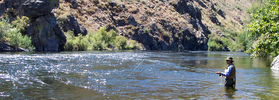
The current status of public access to fish the South Fork of the Boise requires some explanation.  The short story is the roads are open but the Forest remains closed.  The land between the road and the South Fork of the Boise River is part of the Forest.

The longer story is more complicated and deserves some detangling.

With the Elk Complex Fire a large closure on the Mountain Home Ranger District (and adjacent portions of the rest of the Boise National Forest) went into effect as the fire spread to its current 131,258 acres.  The roads from Highway 20 leading to the South Fork are under the jurisdiction of the Mountain Home Highway District.  As the fire involved much BLM land in the 149,384 acre Pony Complex, the road closures were extensive.  Fire maps show the South Fork Boise River downstream of Anderson Ranch Dam constituted a shared border between the two wild fires.  So the south bank of the South Fork is the Pony fire and the north bank is the Elk fire, if the maps are correct.

On Tuesday August 20, with the fires reaching close to containment, the closures were adjusted.   Despite different government jurisdictions involved, a single announcement was issued and stated in part, “On the Pony Complex, all areas and roads affected by the fire will reopen, including all Elmore County roads.”  The roads leading to the South Fork Boise from Highway 20 which were involved in the Pony fire were opened to the public at 5:00 p.m.

The news release announcing the changes stated in its lede, “With the reduction of fire activity on the Pony and Elk Complexes, the current Forest closure area has been revised and will be significantly reduced effective Tuesday afternoon, August 20 at 5 p.m. In addition, all Elmore County roads and several Boise National Forest roads will reopen on the same date and time.”

However, despite conflating a smaller forest closure area and reopening of Elmore County roads in the same announcement, the fact is the areas where the Forest reopened is in a different location, mainly in the Middle Fork Boise River country well to the north.   The National Forest lands in Elmore County along the roads leading to and along the South Fork Boise River remain closed.

The closure order at the Boise National Forest website is at http://prdp2fs.ess.usda.gov/detail/boise/home/?cid=STELPRDB5035663 and sometimes it does not appear to function on some browsers.  It is also available at http://www.inciweb.org/incident/article/3616/20527/.  And better yet a closure map is here:

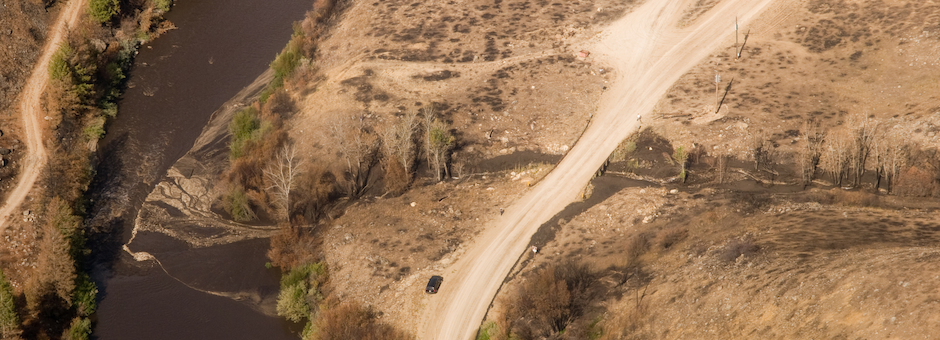
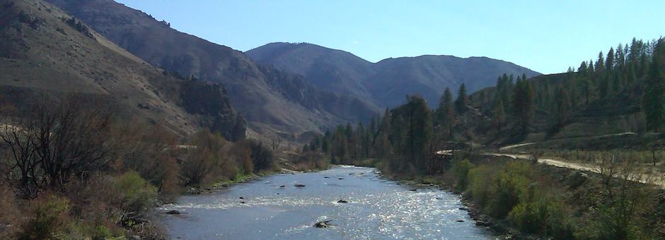
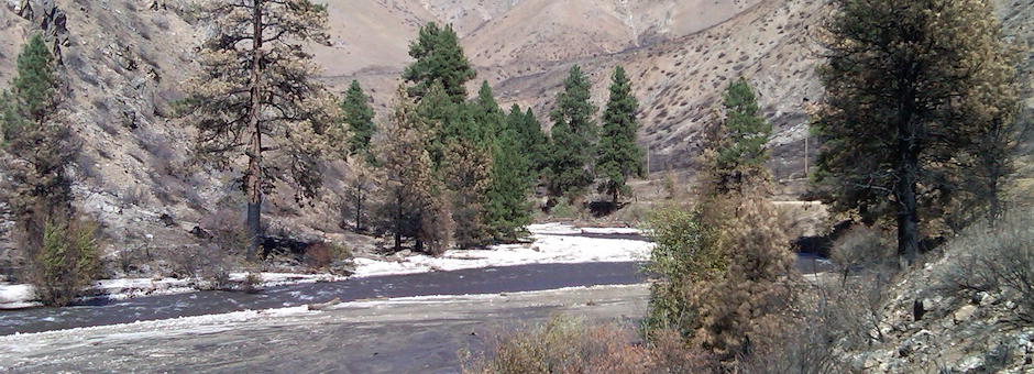
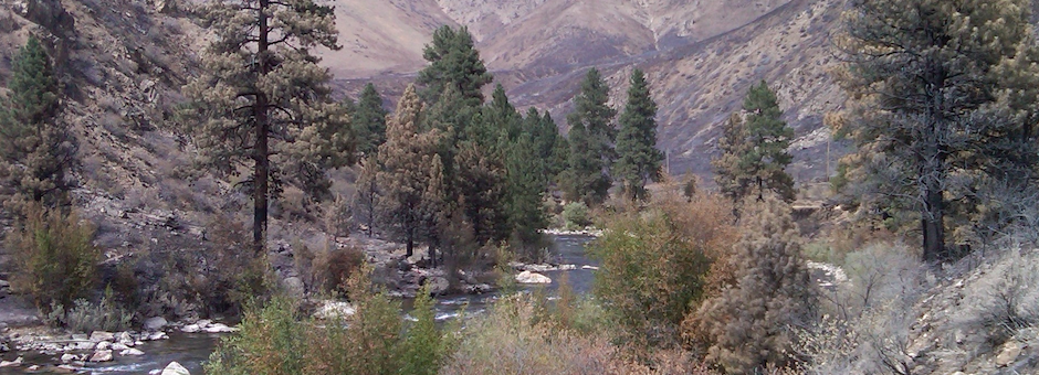
Previous blog posts document the variety in the extent and severity of the wild fire along the South Fork Boise River.  Many places did not burn.  Yet others did and there are many trees damaged by the fire along the streamside riparian lands that constitute a potential safety hazard to the general public.  

In addition the Forest Service and Bureau of Land Management have extensive areas to assess where emergency stabilization and rehabilitation may be needed.  The Granite Creek watershed, tributary to the South Fork Boise near the Pine Tree Hole, is one example of such an area.  The agencies plan to complete a field assessment of the burn areas prior to changing the closure order.  This assessment reportedly could take up to two weeks, and it is not clear if the 11.3 mile long corridor from Anderson Ranch Dam to Danskin bridge (an area that equates to approximately 2,000 acres) will come early, middle or late in the assessment process of  the 280,642 acres affected by the two fires. Or, if areas will be opened in stages as they are assessed, versus the closure being in place everywhere until the entire assessment is complete.

So at this time anglers who are interested in visiting the South Fork are presented with the shopping equivalent of “look but don’t handle the merchandise.”

Fire Effects: Cow Creek to Danskin

We made an afternoon trip to the South Fork Boise River on August 21 to observe the effects of the Elk Fire.

Prairie Road with burned area south of the descent into Cow Creek

Since the aerial photos that came in Monday were of the South Fork from Reclamation Village to Indian Point (or Indian Rock for some of you) our trek was for the downstream section from Cow Creek bridge to Danskin Bridge.

Lower Cow Creek where the fire burned through

The drive descending Cow Creek showed many sections not affected by fire while the hillsides had burned.  The photo above shows near the end of cow creek where it enters the valley bottom the fire burned through the trees and took the brush and grasses.

Cow Creek Riparian Restoration sign from 1992

Long hidden in the brush was the commemorative sign of the Cow Creek riparian restoration project from 1992.  What is left of the wording and logos is ash burned on to the medal sign.  The logos for Trout Unlimited, Forest Service and Boise Valley Fly Fishers are still visible.  The beer bottle was not placed there for the photo.  Indeed, cans and bottles are now revealed in many locations where the brush burned, exposing litter from long ago.

View downstream from Cow Creek Bridge

From the vantage point of the Cow Creek bridge the conditions downstream look largely unaffected along the river.

Prairie Road from the Cow Creek bridge approach

In this area the Prairie Road appears to have served as a fire break.  The right edge of the photo shows the edge of the burn down the hill side.

Meadow along braided section

The unburned section (at least as observed from the road) reaches more than a mile.  Despite the area being open since only 5:00 p.m. on Tuesday, by Wednesday afternoon there was already an RV and drift boat settled in at campsite 121Q, also known as the meadow, where the multiple channels join together.  UPDATE 8/23/13:  Actually only the road is open but an area closure on the Forest Service lands is still in effect.

Downstream of 121R campsite

Things get more interesting as one moves downstream past the 121R campsite, also known to some as the “Dead Deer Hole.”  The photo above looks back upstream through a section of stream bank where the brush burned through to waters edge.

Here is a nice close up of the burned area along the river, looking upstream.  In the background the unbuned riparian areas are evident.  Some patches burned and others did not.

Granite Creek culvert

Just downstream of 121R the little stream of Granite Creek meets the South Fork.  But not before it goes through a 36″ diameter culvert under the South Fork road.  The photo above shows the relatively small culvert, a concern given that the watershed as seen in the photo below, appears to have burned over.

Granite Creek watershed

Granite Creek could be a ticking time bomb for the South Fork.  A heavy rain on this watershed could cause a gully washer and if the culvert gets plugged the flood could take out the road.  The amount of sediment that will go to the South Fork is going to go up from this watershed.  The question is how much and what can be done to control erosion.  Fortunately the Forest Service is attuned to these immediate after effects from a fire and will be scouting the burned area for vulnerable locations.

Rock garden and Pine Tree Hole

Immediately downstream of the confluence of Granite Creek and the South Fork is the section known as the Rock Garden followed by the Pine Tree Hole.  The photo above represents the fire effects in a microcosm showing much of the brush burned completely, some with less severe burn, and some riparian brush that is still green.  The trees also exhibit different fire effects where some of the pine trees in the foreground were probably killed by the fire while others in the background appear to be in a position to survive.  In the distance the iconic ponderosa pines at the Pine Tree Hole pullout appear to have made it.

Below the Pine Tree Hole

Areas downstream of the Pine Tree Hole show more of the fire damage is upslope from the river, where many of the conifers burned, some also will survive.

Looking upstream from the Danskin Rock Shelter

Further downstream the juxtaposition of fire effects on upslope v. riparian areas is more evident.  Here, one of the pines on the south side nearly all brown but the others upstream appear in better shape.

Pierce Creek watershed

Then we got to Pierce Creek.  Site of the major investment in a new bridge that made possible Pierce Creek to be reconnected to the South Fork of the Boise River, the watershed appears to have a significant amount of fire.

USGS gage

One casualty of the fire is the stream gage that USGS had installed on Pierce Creek.

Pierce Creek bridge and South Fork road

Volunteers who helped plant around the area around the bridge over Pierce Creek may be pleased to learn that their efforts are not lost to fire as the vegetation in that area escaped the severe fire effects observed in the foreground where the grass and brush turned to ash and where the trees and willow burned along the creek.

Pierce Creek watershed from the Prairie Road

Further up in the watershed the view from the Prairie Road makes evident the fire effects across the watershed.  Reports from the first day of the wildfire had stated the burn went up House Mountain, the highest peak in the photo above.

Actions to lessen the erosion into Pierce Creek and to recover the watershed will be a focus of future efforts.  These efforts are needed to secure the investment in the Pierce Creek bridge that has opened this watershed to the South Fork of the Boise River.  This website will continue to update interested readers as government agency plans are formed to address the near term rehabilitation actions.


First Fire Photos Emerge

Here are some aerial photos of the South Fork Boise River canyon downstream of Anderson Ranch Dam.  Photos courtesy the US Forest Service

These are the first photos to emerge since the wildfire (Pony on the south side, Elk on the north side) swept through the canyon August 8 – 10.

Order is from upstream to downstream.  If you click on the photo you will get a larger version and it will do a slide show of the seven pictures.  If you just scroll through the article you get a little bit of commentary.

Looking upstream Reclamation Village at left and Anderson homestead in the middle

The single house at Reclamation Village is still standing.  As are many trees, or at least the canopy is green.  It appears the South Fork road and the driveway through Rec Village served as a fire break.  Looking upstream, the bridge over the river leads to the home on the south side of the river and the area surrounding that appears to have burned severely.  Reportedly the fire swept into the South Fork canyon from the Dixie area on the plateau to the south.  It came down Dixie Creek and reportedly burned some out buildings.  But in the foreground of the photo it appears some of the hill side has some unburned areas.

Further upstream on the hill slope south of the river it appears several conifers, ponderosa pine mainly, may have survived.

This photo shows three of the turn outs and campsites downstream of Reclamation Village, which is at the top of the photo.  Obscured by the apparent greenery is the Reclamation Village boat launch, camping and rest room, designated as route 121I in the Boise National Forest Motor Vehicle Use Map.  The dredge pile on the south side of the river (right side as we look upstream) may have protected some vegetation from the fire. It is across the river from the pull off 121J, also known by many as the Bridge Abutment Hole.  Near the bottom of the photo is pull out and campsite 121K.

In this section of the river the hill sides burned severely on both sides of the river.  The valley bottom has areas both burned and unburned.  Both sides of the river have some areas that look relatively unscathed and others where some of the trees near the river were scorched.

Hills blackened but stream side vegetation still green in places

This photo shows the hill side on the north side of the river where areas are black and other spots appear not burned as severely or not burned.  This is the 121L driveway and camp site.

Close up of river bank and drive way

The fourth photo above narrows in on 121L and the river bank, and it gives us a good idea what burned and did not burn.  While the scientific literature on the effects of fire on riparian areas is not that easy to find, one study published ten years ago has a synthesizes information with some observations potentially relevant to the South Fork Boise:

Most cottonwood and willow species respond to browsing by beaver and fluvial disturbances through coppice sprouting from stems, as well as production of root suckers (Rood et al., 1994). These adaptations also contribute to regeneration following fire. In floodplain forests along the Oldman River in southern Alberta, Canada, 75% of the cottonwood trees sprouted vigorously from stumps within 5 months of an early spring fire (Gom and Rood, 1999). Root suckers were also common, demonstrating that fire stimulated clonal regeneration of native riparian cottonwoods. In south-central New Mexico, over 40% of Rio Grande cottonwoods (Populus deltoides wislizenii) that burned in two study sites produced shoots that survived at least 2 years following fire (Ellis, 2001). About 73% of the native Goodding willow individuals produced shoot sprouts during the first 4 months following burning, but only 55% of the exotic tamarisk (Tamarix ramosissima) individuals sprouted (Ellis, 2001).

Importantly the paper also notes this caution:

Season of fire may be a critical factor in determining the capacity of cottonwoods and willows to survive fire. For example, severe summer fires in the southwestern US may kill some cottonwoods, particularly trees that are stressed or senescent (Busch and Smith, 1993; Busch, 1995).

Islands on the South Fork Boise appear less affected by fire

The photo above shows in the areas where the stream is braided into multiple channels the islands appear less affected than the riparian areas on outside stream banks.  Campsites 121L and 121M are both in the photo.

Looking downstream. North side burn appears worse than hills on south side of the river

The photographer then pivots and looks downstream with campsite 121M still in the frame.  And, further in the distance is 121N where the South Fork and the road converge at the downstream end of the bench along the river.

In places along the canyon where the hill sides burned the immediate risk is a heavy storm could cause erosion.  The government agencies will look first at emergency rehabilitation actions that need to be implemented to lesses the risk of negative effects from such storm events.  Lots of rain could cause gully erosion and wash out a section of the road or put sediment into the South Fork of the Boise River.

For example, the ridge line in the distance of the photo above is the divide beyond which water drains into Rough Creek, the small stream that dumps in to the South Fork at the site of the 1996 landslide.  If this catchment burned over and has little vegetation and ground cover a significant rain storm could lead to a gully washer-type event.

Indian Point

The last photo above is cropped from the previous one and zooms in on Indian Point (121O), the boat take out point for many float and fishing.  The trees in this area appear rather unscathed.

No photos yet of areas downstream.  When we get more information we will post it.

Photos courtesy the US Forest Service.


South Fork on Fire

Lightning-caused fire swept through the South Fork Boise River canyon August 8-9 and while reports are fragmentary it sounds like the canyon from Dixie Creek downstream to Pierce Creek was affected.  The only photo so far is this:

This is a Google Earth image with overlay from the MODIS satellite fire detection and shows the canyon area under fire.

We will try to get pictures when they are available.


Opening Weekend on Video

We found this video posted on the Boise Valley Fly Fishers Facebook group.  Opening Weekend on the South Fork Boise River.