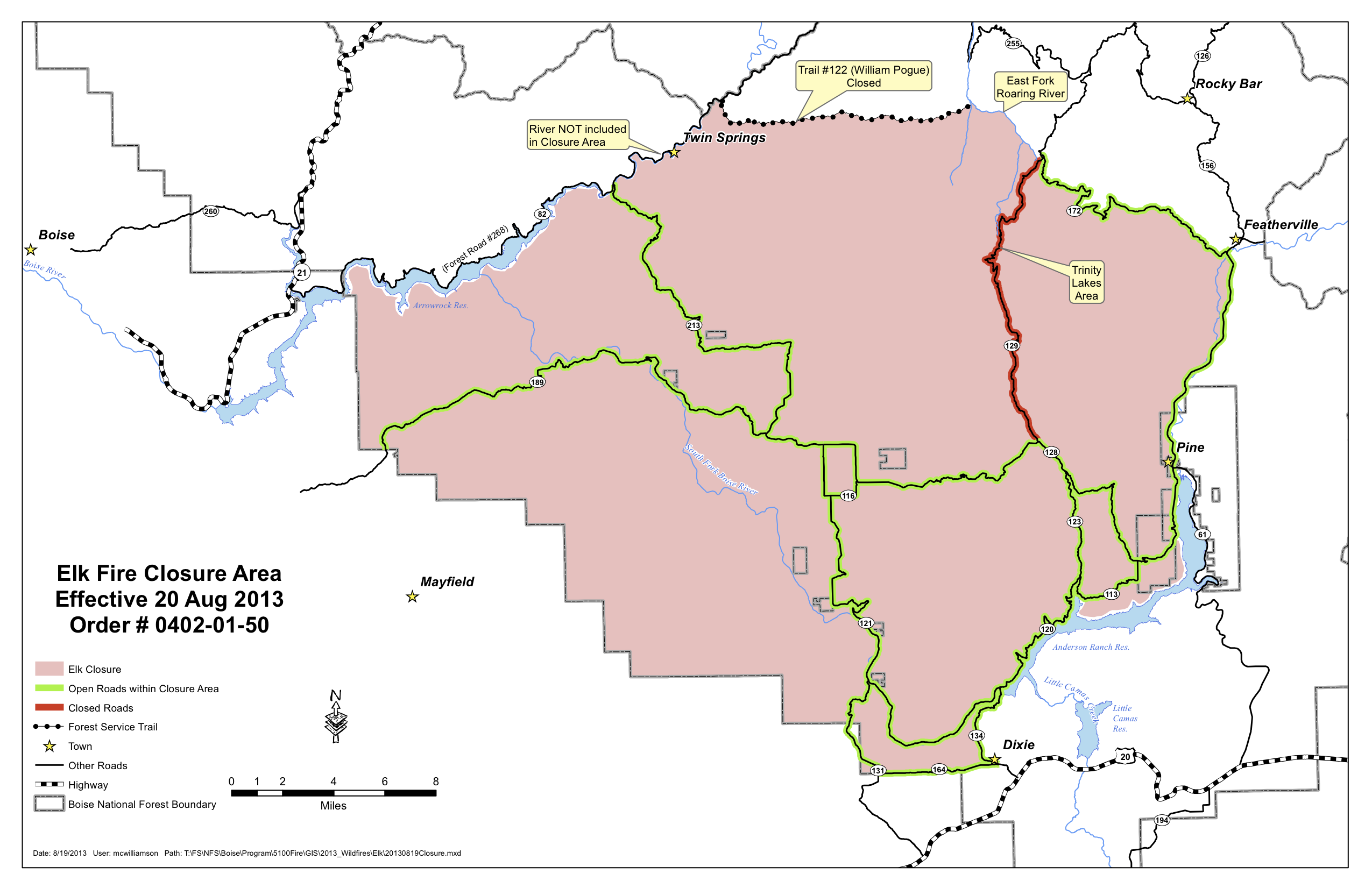
The current status of public access to fish the South Fork of the Boise requires some explanation. The short story is the roads are open but the Forest remains closed. The land between the road and the South Fork of the Boise River is part of the Forest.
The longer story is more complicated and deserves some detangling.
With the Elk Complex Fire a large closure on the Mountain Home Ranger District (and adjacent portions of the rest of the Boise National Forest) went into effect as the fire spread to its current 131,258 acres. The roads from Highway 20 leading to the South Fork are under the jurisdiction of the Mountain Home Highway District. As the fire involved much BLM land in the 149,384 acre Pony Complex, the road closures were extensive. Fire maps show the South Fork Boise River downstream of Anderson Ranch Dam constituted a shared border between the two wild fires. So the south bank of the South Fork is the Pony fire and the north bank is the Elk fire, if the maps are correct.
On Tuesday August 20, with the fires reaching close to containment, the closures were adjusted. Despite different government jurisdictions involved, a single announcement was issued and stated in part, “On the Pony Complex, all areas and roads affected by the fire will reopen, including all Elmore County roads.” The roads leading to the South Fork Boise from Highway 20 which were involved in the Pony fire were opened to the public at 5:00 p.m.
The news release announcing the changes stated in its lede, “With the reduction of fire activity on the Pony and Elk Complexes, the current Forest closure area has been revised and will be significantly reduced effective Tuesday afternoon, August 20 at 5 p.m. In addition, all Elmore County roads and several Boise National Forest roads will reopen on the same date and time.”
However, despite conflating a smaller forest closure area and reopening of Elmore County roads in the same announcement, the fact is the areas where the Forest reopened is in a different location, mainly in the Middle Fork Boise River country well to the north. The National Forest lands in Elmore County along the roads leading to and along the South Fork Boise River remain closed.
The closure order at the Boise National Forest website is at http://prdp2fs.ess.usda.gov/detail/boise/home/?cid=STELPRDB5035663 and sometimes it does not appear to function on some browsers. It is also available at http://www.inciweb.org/incident/article/3616/20527/. And better yet a closure map is here:
Previous blog posts document the variety in the extent and severity of the wild fire along the South Fork Boise River. Many places did not burn. Yet others did and there are many trees damaged by the fire along the streamside riparian lands that constitute a potential safety hazard to the general public.
In addition the Forest Service and Bureau of Land Management have extensive areas to assess where emergency stabilization and rehabilitation may be needed. The Granite Creek watershed, tributary to the South Fork Boise near the Pine Tree Hole, is one example of such an area. The agencies plan to complete a field assessment of the burn areas prior to changing the closure order. This assessment reportedly could take up to two weeks, and it is not clear if the 11.3 mile long corridor from Anderson Ranch Dam to Danskin bridge (an area that equates to approximately 2,000 acres) will come early, middle or late in the assessment process of the 280,642 acres affected by the two fires. Or, if areas will be opened in stages as they are assessed, versus the closure being in place everywhere until the entire assessment is complete.
So at this time anglers who are interested in visiting the South Fork are presented with the shopping equivalent of “look but don’t handle the merchandise.”


