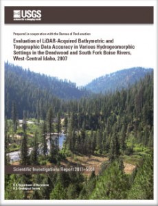
The US Geological Survey (USGS) last year issued a science report on the use of laser technology to help exploring the depths and shape of the South Fork Boise river channel from the air.
 The report (.pdf) carries the complicated but self-evident title of Evaluation of LiDAR-Acquired Bathymetric and Topograhic Data Accuracy in Various Hydrogeomorphic Settings in the Deadwood and South Fork Boise Rivers, West-Central Idaho, 2007.
It sounds and is complicated. And NASA is involved too. In September and October 2007 the USGS contracted with the National Aeronautics and Space Administration to fly the South Fork Boise River downstream of Anderson Ranch Dam (and also the Deadwood River downstream of Deadwood Dam). The NASA airplane was equipped with the sophisticated equipment that shoots a green laser light at the ground and it measures the distance from the plane to the ground. Assume this goes on thousands of times a second across a swath of land beneath the plane (say, a couple hundred yards wide), and if you know the exact altitude of the plane, you can then calculate the elevation of the point on the ground where the laser hit and then reflected back. And, green light can go through water, if it’s clear enough.
So, the NASA Green LiDAR plane was put up over Deadwood and SF Boise to scan the ground and the channel bottom. The return data was scrubbed to just include the “ground shots” or “bare earth.”
At the same time the plane was up, they sent out GPS surveyors in three areas for each river.
In the flat areas, the LiDAR and GPS were within 1/2 to 1-ft of each other. Under water they were within 0.8 and 2.5 feet on agreeing (a result of “complex hydrogeomorphic (river bottom) environments within the streams, such as submerged aquatic macrophytes and air bubble entrainment; and those along the banks, such as boulders, woody debris, and steep slopes.”)
So, it appears that the LiDAR has a tough time working along the topographic breaks of the banks (tops and toes), where there’s large woody debris (LWD) in-channel or moss in the water, or aerated water.
It seems that while the LiDAR is good on the ground it still has a way to go for underwater uses. As far as which is more sensitive, aquatic habitat assessments (habitat suitability indices – HSI) are probably a more problematic undertaking with LiDAR. River channel cross-sections are certainly affected and a 2.5 ft error is not good, but characterizing the bug’s habitat may be the tougher of the two.
The LiDAR was able to define channel extents fairly well.
So as far as using the data to figure out the best holding water for a large trout or char, don’t bet on it.
Given the error for laser-based measurements through water perhaps it would be most useful for more generalized and less detailed assessments that at the same time can cover a greater extent of a river. It might be useful to develop some measure of pool/run/riffle ratios over long reaches of channel. A lot of work went into surveys of rivers in the Columbia Basin in the late 1940s, then repeated in the early 1990s and resulting changes in pool volume and quality had a lot to do with policy changes affecting commercial timber harvest from National Forest System lands. One report that was a fulcrum of this change can be found here (.pdf) that was based on studies that looked at present day aerial photos compared to photos in the 1930s and 1940s. Perhaps LiDAR can add value to the information about broader river characteristics and not so much the finer data.


