Among the debris flows into the South Fork Boise River on the evening of September 12, Granite Creek is worth a look. For one reason, we said it was a ticking time bomb here and here. Secondly, the debris flow appears significant in its scale and extent.
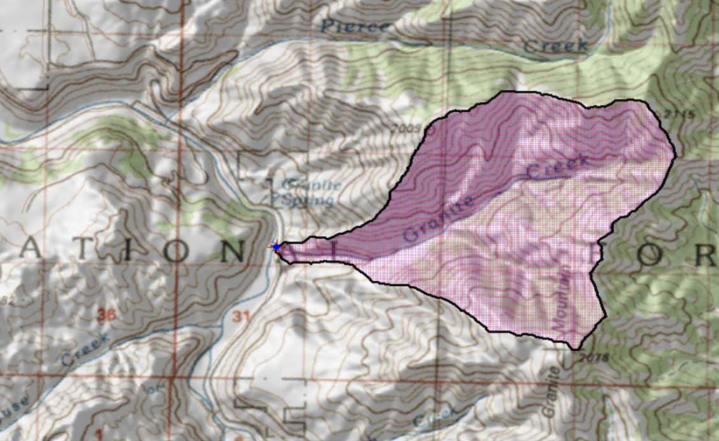
First, the map above shows the watershed is about halfway between the Cow Creek bridge and the Danskin Bridge. Granite Creek is a tiny little thing with average flows in the winter months of a couple of cubic feet per second. In the spring there could be 10 to 20 cfs in the stream, based on a statistical report. All of this fits in a culvert under the South Fork road with a pipe of 36 inches in diameter.
We know from the 1978 study of the South Fork and tributaries that Granite Creek did have some documented spawning in it. In more recent years the culvert is considered an impediment to aquatic organism passage. Attempts to assess the culvert’s outflow were frustrated by too thick vegetation and steep slopes off the South Fork road.
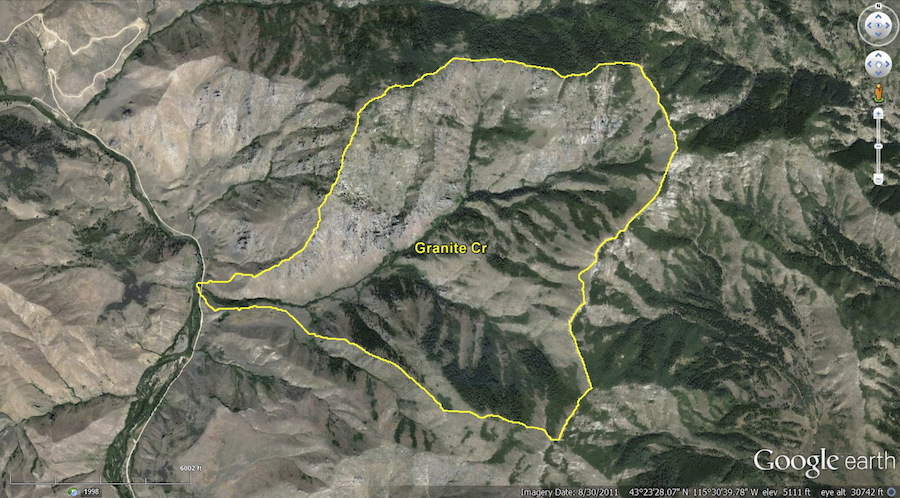
There is (or was) some forested sections in the Granite Creek watershed, primarily on the north facing slopes. It is approximately 3.5 square miles in size.
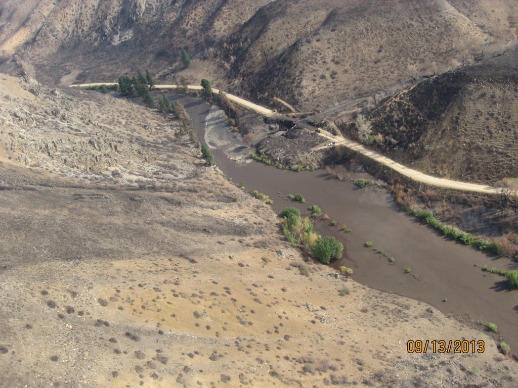
The photo from the air on Friday the 13th is dramatic:
First, the debris flow overtopped the South Fork road as the little culvert was either plugged or overwhelmed. The debris fan extends well downstream as indicated by the tan or lighter-colored area in the South Fork Boise River, when compared to the chocolate color of the river upstream and on river left as it routes around the debris flow.
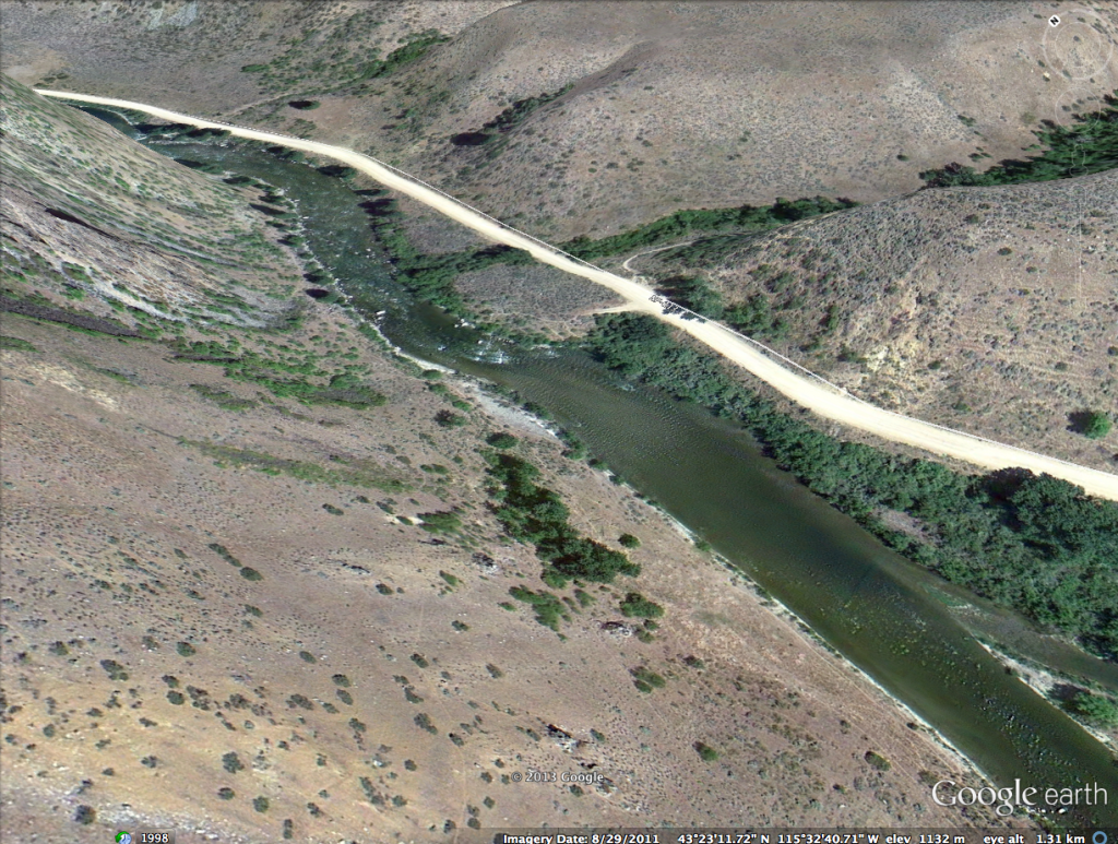
Another shocker is from the photo below using the Google Earth image generally in alignment with the above photo taken on Friday:
Both photos show a river flowing at 600 cfs as the Google Earth flyover was August 29, 2011. The debris flow as apparently covered the Rock Garden section of the South Fork, burying that stretch of pocket water just as it enters the Pine Tree Hole.
More amazing is the amount of water backed up with the mud and debris deposited in the river. The water is backed up and at a much higher elevation, so much at the willows and other stream side bushes are inundated, surrounded by muddy waters. This is most apparent along the left bank. At the bottom of the slope the group of trees appears in water too! The water elevation appears to be 2-3 feet higher than normal.
This condition will not last as the river will continue to cut a channel through the debris and the smaller size material (silt and sand) will be carried downstream. That Pine Tree Hole is going to be full of material for some time.
How fast the river cuts a channel and clears out the smaller material is going to be affected by how much flow is in the river. The winter time flows of 300 cfs commence on September 16, so what ever energy the river has to move the material downstream will be greatly reduced.
A natural follow-on question is the effect of this and the other debris flows on the South Fork Boise River fishery. This is a question much more difficult to determine at this time. The extent of the numerous locations where flows entered the river and apparently blocks flows on Thursday the 12th must be considered in a cumulative fashion. A full accounting of the flows and estimates of each disturbance event would be a good first step.
A further consideration is that while fish populations can be affected by these type of disturbances and recover over time, the cumulative effect of several debris flows into a river that has a controlled flow release regime could mean the recovery of the river will be dependent on how the water releases are managed in the spring and summer months. For example, could artificial spring freshets be managed in order to help move sediment through the river system? This is a topic that conservation and angler groups will need to work with the government agencies and other affected water users.


Pingback: Layman’s Guide to South Fork Landslides |